TCAT Introduction
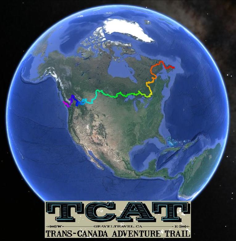
The TCAT begins on the eastern coast of Newfoundland the TCAT crosses Labrador, Quebec, Ontario, Manitoba, Saskatchewan, Alberta and British Columbia. Each province is unique and offers something to the route. The cultural differences along with the differences in terrain make the TCAT something truly special.
The Trans Canada Adventure Trail is a 15, 000 kilometre (approx) gps route across Canada. A group of people have spent five years creating the route and we are happy to announce that we are finished.
The TCAT began as a concept in 2007 and work began in earnest shortly after. The scope of the project is massive; Canada is the widest country in the world. After realizing that there was no way this route could actually be finished we explained our dilemma on various internet forums and several people came forward to help. The TCAT became a group project and we would like to sincerely thank the contributors.
Mike Buehler, Fabrice Tremblay, Chris Regier, Jimmy Rodrigue, David Williams, Gord Jones and Ross Glover.
Each of these individuals spent countless hours exploring back roads and trails and came up with a route through the area in which they live. This local knowledge was invaluable in creating the TCAT and the benefits are huge. To each of these folks we would like to give a huge “THANKS!”.
Many other people contributed as well by pre running various sections of the route to verify the gps files and terrain. The list is quite extensive, you know who you are and your help is greatly appreciated. Jenna, Step and everyone else involved...THANKS!
To travel across Canada using the back roads we have laid out can almost be compared to stepping back in time; a time when things were simpler, when things moved slower. We hope you enjoy the salt of the earth people you’re bound to meet as well the amazing scenery and the abundance of wildlife that you are sure to encounter.
To those who complete the TCAT we salute you, it's one heck of a long ride!