TCAT
Chapter: The Taiga
Current Route Filename: TaigaR1.0
Created By: Ted Johnson
Length: Approximately 1900 kilometers
This section of the TCAT follows the Trans Labrador Highway for most of the chapter. The name, Trans Lab Highway is not quite correct as there are a few different roads that make up this section (Lab 500, Lab 510 and Quebec 389), but these roads are commonly just put together and called the Trans Lab by most folks. The surface of these roads is primarily packed sand and gravel. The road is built up on top of the ground and is referred to as a raised highway. The TLH is notorious for dust, soft shoulders and sand build ups in the valley dips. These hazards along with the regular hazards presented by remote roads (wildlife, potholes, industry trucks, etc) make the TLH a serious endeavour for many people.
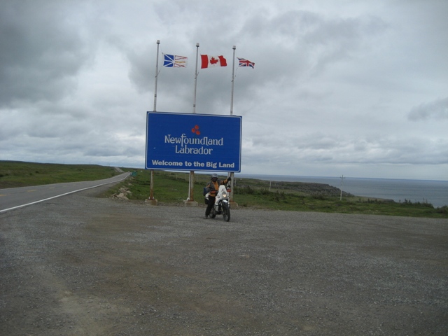
The Trans Lab begins as you step off the ferry from Newfoundland in the small town of Blanc Sablon, Quebec. 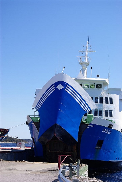
Photo by Cosmin Col?ea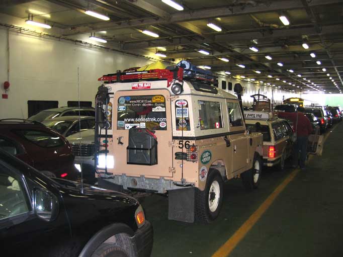
Photo by James Young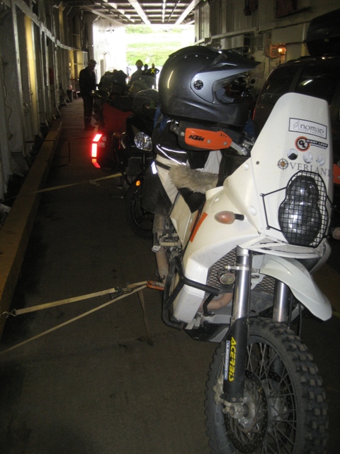
Straps are provided at no charge for tieing bikes down
The first 83 kilometres is on a paved road heading north up the coast to the town of Red Bay. This section of the TLH sees you entering the province of Labrador and offers some beautiful coastal scenery. Red Bay has a government run interpretation center that is worth checking out for a couple of hours. This old fishing village is very picturesque and well worthy of a stop before you head inland.
The season for travelling the TLH varies from year to year. May will likely see snow on the sides of the road if not on the road and October is a guarantee of snow. This leaves a window of opportunity that is four months long. We have seen near freezing level temperatures in early August and 30 degree Celsius weather in late September. Our advice is pack for the worst and hope for the best.
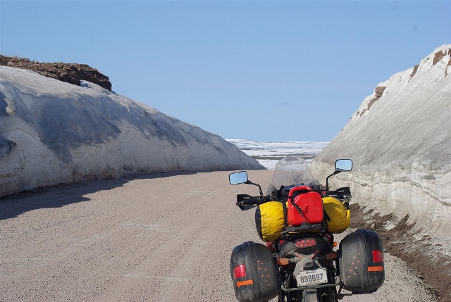
Travelling in May means snow Photo by: Cosmin Col?ea
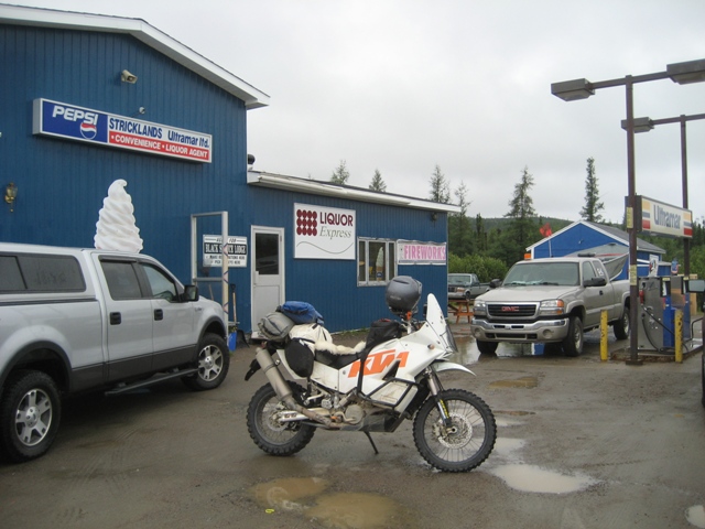
Highway 510 turns inland and will bring you the small town of Port Hope Simpson. This 139 kilometre stretch of road is gravel surfaced. Port Hope Simpson has a gas station that keeps decent hours and is open seven days a week. A small convenience (grocery store) store and a hotel as well as a couple of bed and breakfasts are what this small town has to offer along with its scenery and warm hospitality. This section of the TLH offers some great views of a typical taiga landscape; barren and desolate. This section of road is famous for its strong cross winds and may present a challenge in lighter vehicles or on loaded bikes. The landscape is very rugged and evidence of the high winds is obvious when looking at the trees and shrubs that are permanently bent over from the wind.
{module TLH Wind|none}
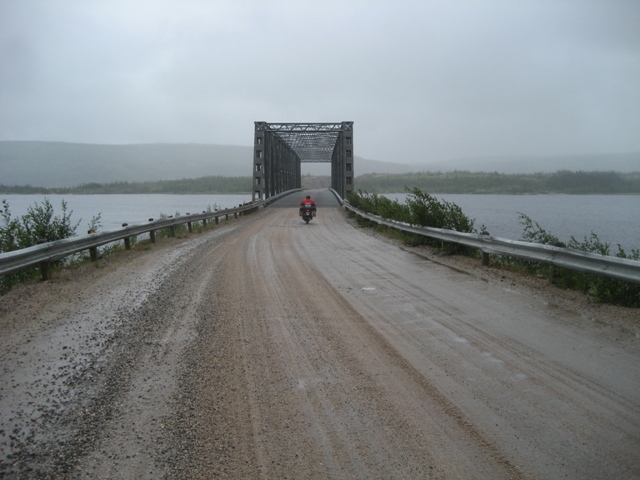

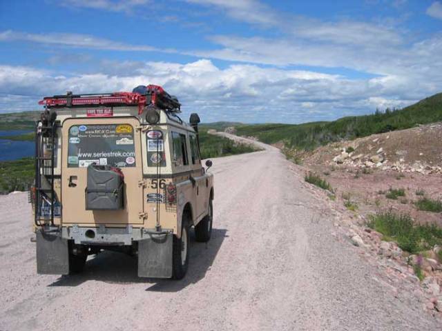
Photo by James Young
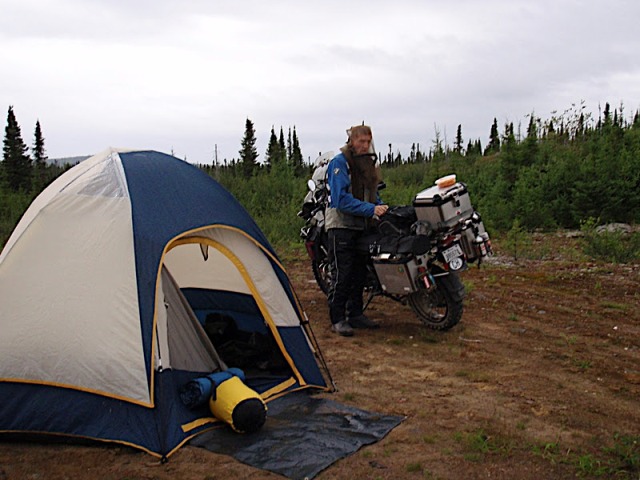
After leaving the small town of Port Hope Simpson there is a long remote stretch of gravel highway to the next town along the Trans Labrador Highway. A distance of approximately 420 kilometres must be covered with no opportunities for gas along the way. Filling up with fuel in Port Hope Simpson is a must do for most people. We have found that the weather, road conditions and winds along this remote stretch may surprise you on your gas mileage and we encourage you to add a little extra so that you don’t run out of fuel as there is no development along this stretch of highway. There are some great views and a couple of convenient locations to camp informally. This section of road is known as the “new section” and was opened in the spring of 2010. Prior to it’s opening people used to take a ferry from either the town of Cartwright or from the island of Newfoundland and travel to Happy Valley.

Not the most luxurious motel but a warm welcome after miles on TLH
For folks looking to spend some more time in this area there is a road from just outside of Port Hope Simpson to the town of Cartwright. It’s a 200 kilometre scenic drive on gravel roads; return is by the same way you got there. Cartwright was a popular town prior to the new section of the Trans Lab Highway being built; I suspect it will face some challenges without the ferry traffic in the future.
Black flies, the TLH has them…in abundance! Depending on the time of year that you choose to travel this route you may or may not have to deal with the black flies. The choice is yours, either very cold temperatures or black flies. We highly recommend you pack some sort of mesh bug protection as these insects don’t get phased by any bug sprays you can purchase. Being prepared for them can turn a real nuisance into a manageable situation.
The next stop for most people will be the small city of Happy Valley/Goose Bay. This town has a population of just less than 8000 and offers a wide variety of amenities. Originally constructed in the 1940’s Goose Bay was built as an armed forces base and to date is still the largest air base in north eastern North America. It acts as an unused alternative landing site for NASA space shuttles due to its length and size. The base is in decline in recent years and in 2006 several governments (Germany, Italy, etc) did not renew their contracts. The future is uncertain for this air base. Arrival to Goose Bay/Happy Valley is either from the west or south (Trans Lab Highway) or via ferry. Since the “new road” has been completed the ferry schedule has been greatly reduced. Products and materials bound for this town have been limited due to the limited boat traffic and prices and availability for goods is being reflected.

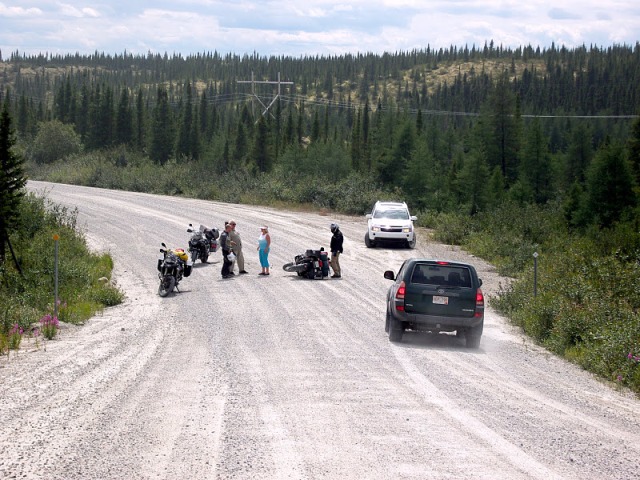
Broken down, the TLH sees lots of traffic so help is often available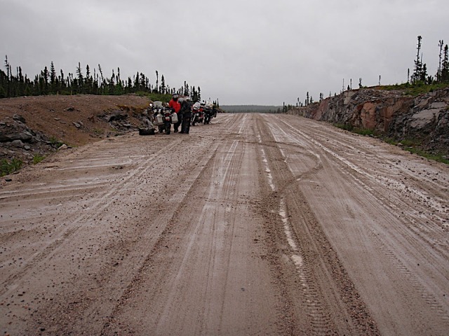
Slick conditions after some heavy rain. Photo by Chris Pavolitch
Leaving Happy Valley the next town along the route is Churchill Falls. A distance of 291 kilometres separates the two towns with most of it being gravel. Road construction is an ongoing activity and should be expected. This section of road is currently being paved but progress is slow and we’ve been told it won’t be complete until 2016 or later. The road is a wide paved highway and see’s regular traffic from locals and from industry.

Photo Above by Tony Peirce, just outside of Churchill Falls


The surface gets very thick when wet. Makes for pucker moments when it grabs your front wheel.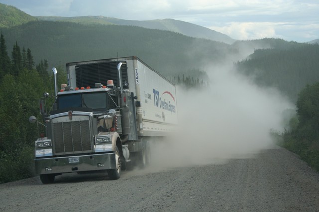
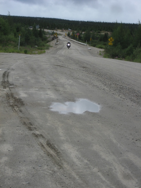
The TLH is notorious for dust when the conditions are dry.
Churchill Falls is a typical industry town. The Churchill River was dammed in 1970 and the water was redirected to what is known as Churchill Falls. With the building of the dam came the need for a town to support the workers. A population of approximately 650, this town offers a gas station, a pub, a hotel and a couple of lodges. Camping is available just outside of town. Like any industry town, Churchill Falls is not setup for tourism; most folks use it for what it is a convenient stop over. A tour of the dam can be arranged and a side trip up some gravel roads along the east side of the reservoir is possible.
After leaving Churchill Falls you continue west along the Trans Lab for 205 kilometres to the small city of Labrador City. The road is primarily gravel but is being paved in sections each year. “Lab City” is a fairly modern place and has most modern amenities such as fast food chains, hotels, etc. With a population of around seven thousand, Lab City consists primarily to support the different industries in the area. Founded in the 1960’s to support the large iron ore mine just outside of town, Lab City is considered one of Canada’s most remote cities. Many travelers use this area as a stop over as it offers most items a traveller might need and well, it’s the only place around for miles.

Leaving Labrador City you head south past the small town of Fermont (Gas available). The road from Fermont enters the province of Quebec and becomes gravel once again. The road gives a nice view of the massive mining operation. Fermont is a French word meaning iron mountain. The mine was established in the 1970’s and is still currently mining iron out of Mt Wright. The small town and large mine is located approximately 23 kilometres outside of Lab City.
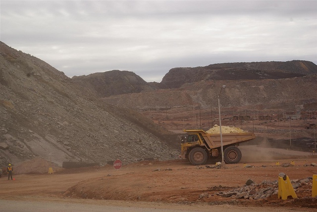
Photo by: Cosmin Col?ea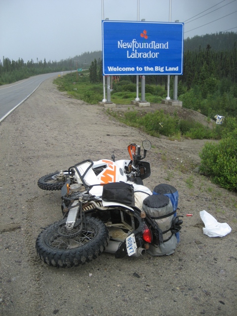
Shortly after leaving Lab City you enter the province of Quebec
The road after the mine which is officially known as highway 389 but is often referred to as the Trans Lab, is gravel and follows a rail line. The rail line is primarily used to transport material from the local mines. Approximately 160 kilometres from the min you’ll come across an abandoned town that was called Gagnon. This town was dismantled in 1985 after the close by mine was shut down. It is a bit spooky to see side streets, curbs, etc but no buildings. A further 75 kilometres brings you to a small outpost called Relais Gabriel. A small cafe and motel with gas can be found here.
Always best to prepared for flat ties. Photo by: Mike Buehler
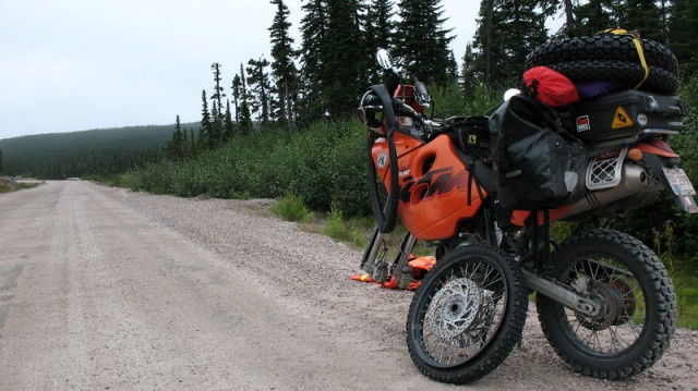
The roads on highway 380 are made up of sand and caution should be taken in the many valleys as the sand can build up and become quite dangerous. This sand is also the source of the famous dust the Trans Lab can offer if weather permits. This stretch of the TCAT has several opportunities for informal camping.
This bike got too close to the shoulder and the front wheel dug into the sand and caused the bike to cartwheel a few times. Minutes later this truck (below) came flying around the corner. Avoid the shoulders as they tend to collapse under you. Photos by Brian Ellis
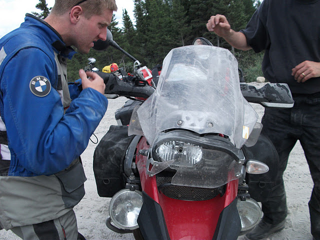
Photo by Brian Ellis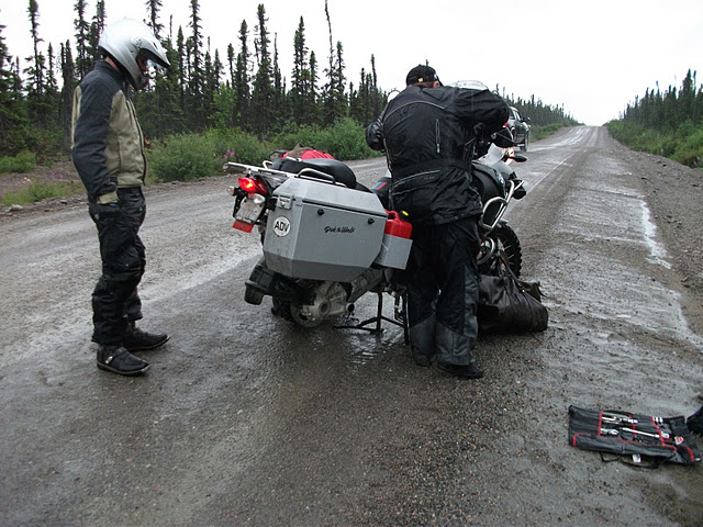
Flat tires on a rainy day, hard on moral
Shortly after Relais Gabriel you turn left and follow a series of gravel logging roads down to highway 138. This section of road follows an active railline for a while. Turning west on 138 the scenic, coastal paved road bring you to the city of Baie Comeau and the end of the Taiga chapter of the TCAT.

Above photo by Tony Peirce, a view of the Manicougan Resorvoir
Baie Comeau, this city has a population of 22, 000 and is the major center for the forestry industry in the area. You’ll find every amenity that can be expected from a city of this size. Situated along the shores of the St Lawrence River, Baie Comeau was first settled in 1889. In 1936 a large paper mill has opened and the city grew quickly and spread out into what you’ll see today.